

|
|
Astronomy is my main passion however my interest in the sky covers a wide range of fields which involves a lot of daytime observing. I enjoy observing atmospheric halo displays, rainbows, unusual cloud formations simply because they are beautiful, transient and extremely photogenic. In recent years I have been getting more and more excited about extreme weather and thunderstorms. This interest was fueled by my observing friend Conor Mc Donald who has been pointing out convective cloud formations and sending me text messages at all hours of the day alerting me to approaching storms and Mammatus cloud displays. In earlier years I never understood what all the fuss was about until I witnessed wonderful examples of these phenomena first hand which has got me hooked ever since. While living at my old home in Crewe Drive, Maghera as a young boy I can recall many days and nights of frightening thunderstorms, floods and powerful gales. One such storm blew our metal fence flat to the ground and the torrential rain which followed turned our back garden into a giant pond. It was so deep I used to paddle across the water in my dad's canoe!
One event which stands out vividly in my mind was the great thunderstorm during the Summer of 2006. To cut a long story short, my sister and I got caught under the most severe lightning storm which I can ever remember. The problem was that we where out in the countryside in the middle of the night and we ended up directly beneath the main core. Cloud to ground (C-G) lightning bolts as thick as telegraph poles where hitting the ground all around us and we could feel a strange sensations above our heads as if the next one had our name on it. The C-G's were hitting at a rate of 1 every 5 seconds. WE were getting chased by the storm, not the other way around. We eventually got saved when our mum sensed trouble and drove out to rescue us at 3 am. As we stepped into the car several deadly lightning bolts hit the ground in front and rear of the car reflecting their terrific light on large puddles and off the torrential rain which had soaked us to the skin in 30 seconds. We arrived home to no electricity and an electric storm which continued all through the night. We firmly believed that had we not been rescued then we would have been badly injured or even killed. It was an extremely frightening experience but the excitement was addictive!
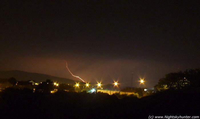 |
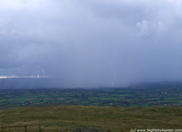
Orange cloud to ground lightning strike over Slieve Gallion (Sperrin Mountains) during the night time thunderstorm of 2006. Image captured from Willow Glynn, Maghera, N. Ireland. The row of street lights marks the west side of the Coleraine road. The building on the right is the Maghera police station. The storm was only beginning at this stage! 15 sec exp, ISO100 at F/3.2 using a Fujifilm S5600 5.1MP camera.
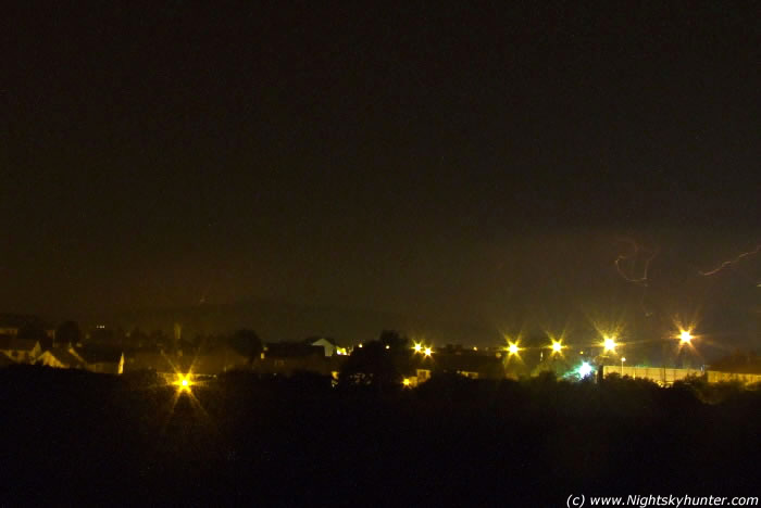 |
Two lightning strikes this time. The first on the far left appearing to hit the mountain top on the east side of Slieve Gallion. The 2nd enters the camera field from the right in the form of twisting loops. 15 sec exp, ISO100 at F/3.2 using a Fujifilm S5600 5.1MP camera.
In 2005 we had another decent nocturnal lightning display. Conor and I observed this one from the top of a large hill near my home which provided us with an excellent view to the horizon. We saw plenty of C-G's and in-cloud lightning with powerful roars of thunder. The night was so hot and humid that we spent much of the storm taking images with no t-shirts on! I had my first digital camera at the time, a humble Fujifilm point and shoot camera which gave me a maximum exposure of 2 seconds on night mode. I took 200 images without a break when I got lucky and caught my very first lightning strike on camera. The feeling of accomplishment was incredible and I knew from now on that this something I was going to get into in a very big way.
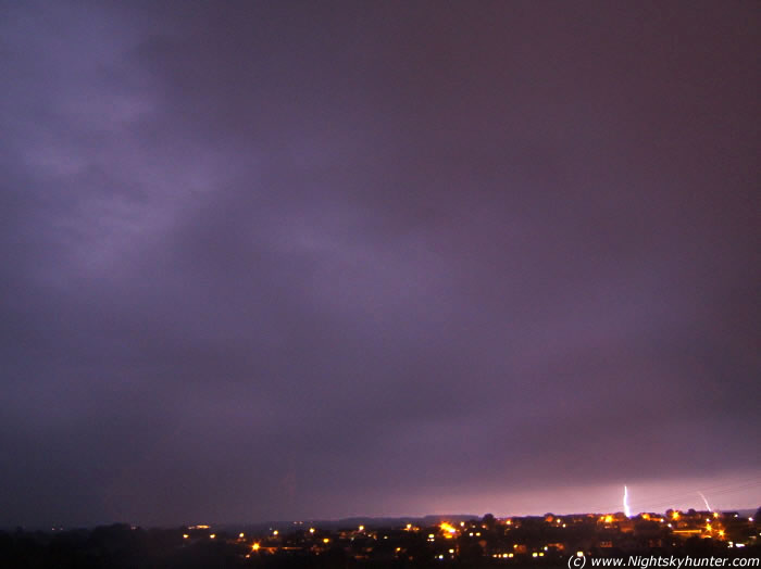 |
4 cloud to ground (C-G) lightning strikes during the night time lightning storm of 2005. 2 red strikes are to the left with 2 white bolts on the right. Camera is facing east. The house lights belong to Crewe Drive and Station Road. Shortly after this image was taken the electricity went out for much of the night and the fire brigade were out in force. Image captured from Willow Glynn, Maghera at approx 01.30 BST using a Fujifilm point and shoot camera at ISO400 and 2 sec exp. I took 200 images before I caught this!
Weather forecast for the day supplied by John Mason....
''Looks rather interesting especially across Eire, Wales, SW and Central England. The warm moist plume will be clearing away eastwards leaving a fairly slow W to WSW flow across the S UK, more southerly over Eire. After a night of broken cloud and clear periods, early sunshine should aid and abet convection to get going readily, with up to 600 J/Kg of CAPE ready to be released across some areas. For the parts of England/Wales thus affected, it does so in an environment in which light W or WSW surface breezes are overtopped by 70kts plus southerly jet winds at 300hPa and 30-40 kts SSW winds at 500hPa. Over Eire, such strong shear is absent, apart from more eastern parts, as the heart of the upper trough moves in from the west.
There seems little to stop fairly widespread convection and although shear at very low levels is less marked, there exists the possibility of funnels/weak tornadoes, especially given the likely complex interactions between outflow fronts should a few clusters of strong cells get going.''
July 16th began as a sunny very warm and humid day. In the early afternoon large convective clouds were starting to bubble into mature Cu and by 14.00 numerous Cumulonimbus clouds with wonderful ice crystal packed anvils appeared from the south. I was talking with my astronomical friend John Mc Connell over the phone who was located in Maghaberry. Together we discussed what we were seeing from our own locations but soon decided to end the conversation to take some images. From my backyard I could see the stunning white anvils growing rapidly, a sure sign of convective action to come.
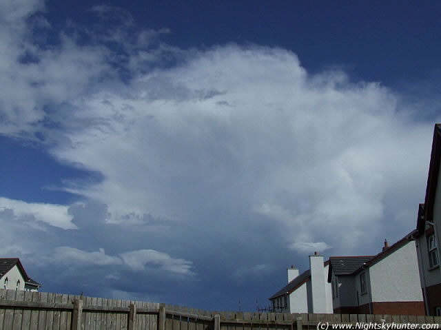 |
View from back garden facing east. Large CB with Incus passing from S to N (right to left).
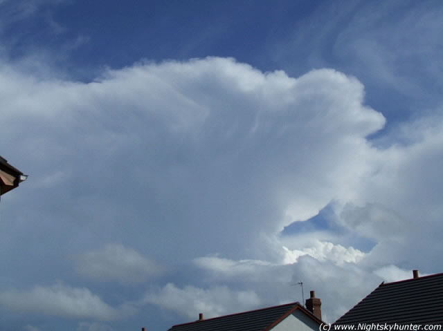 |
View from back garden facing south east. Marked striations in Anvil.
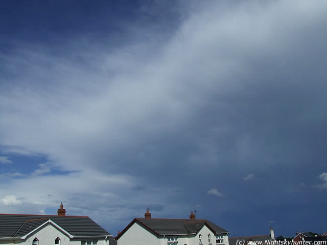 |
View from back garden facing east. Anvil getting closer and larger in size. Note the base getting darker.
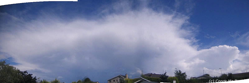 |
Wide field panoramic image of the large CB and Anvil using Brendan Mc Donald's (Conor's dad) camera. Credit: Conor Mc Donald
By now the sky had darkened considerably and thunder could be heard. I got a text message from Conor asking if I wanted to chase the storm to which I replied in the positive. His follow up message informed me that he was already in the car and would RV with me in 5 minutes. I grabbed my camera, tripod and water proof coat and Conor swiftly arrived at my home. We hit the road and picked up his girlfriend Christina who also wanted to join us.
We decided to drive to the top of Slieve Gallion mountain and we headed in that direction at high speed. Through the sunroof of Conor's car we could see giant black thunder clouds towering up to the zenith, they seemed to be boiling with activity. We stopped at a lay by to take some images of the developing storm and got some strange looks from passing cars. A small group of people were sitting out in the heat with a few drinks with very confused faces. Who were these weirdoes who appeared out of nowhere to take images of the sky beside a busy main road?..I told them there was a thunderstorm approaching and they looked at me in disbelief. 10 minutes later I am sure they were running for cover!
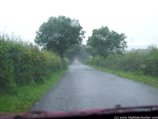
As we continued on our journey the storm began, first with torrential rain then followed by pea sized hail which battered the car roof and windscreen seriously reducing visibility on the road. The thumping on the roof was very loud. We had to pull off the road at one stage. I screwed down the passenger window by a fraction of an inch and hail stones landed on my lap. Loud thunder could be heard and we were treated to a fantastic light show featuring countless C-G and in-cloud lightning sporting orange and white colours which hit in the fields all around us. I was taking images non stop using a fast shutter speed with the camera pointing through the rain soaked windscreen while Christina took video footage with Conor's digital camcorder.
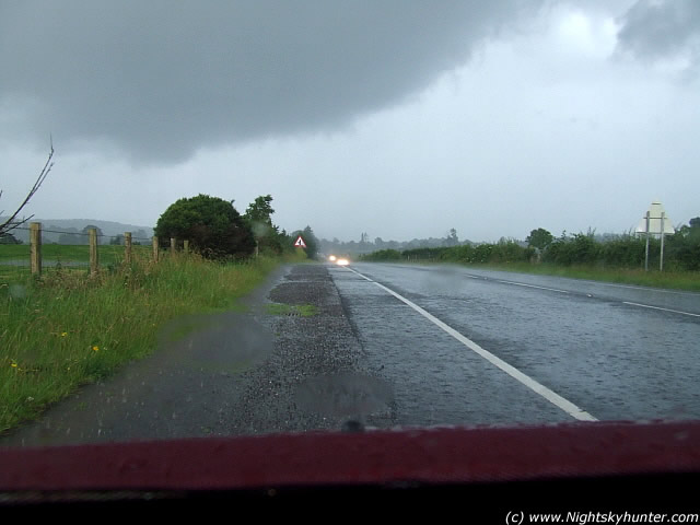 |
The view through the front windscreen when we were getting battered by severe hail.
 |
Lightning was frequent at this stage. Shot through car windscreen.
As we ascended Slieve Gallion the cloud bases with scud were so low that they touched the ground and crossed the winding road to the Summit of the mountain.
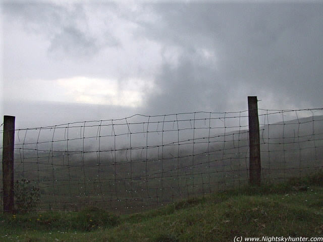 |
Low scud cloud drifting across the mountain taken from the car window.
 |
Conor taking video footage through windscreen.
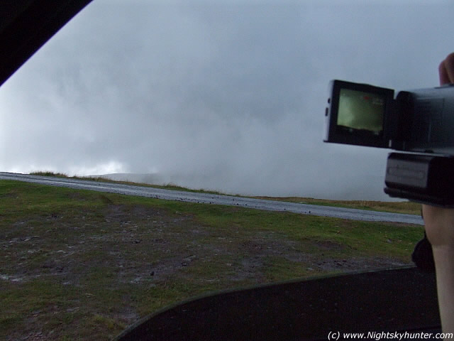
When we reached the mountain top we had to wait for 10 minutes as the storm was too violent. Stepping outside the car would be extremely dangerous so we waited until the rain stopped and storm moved position.
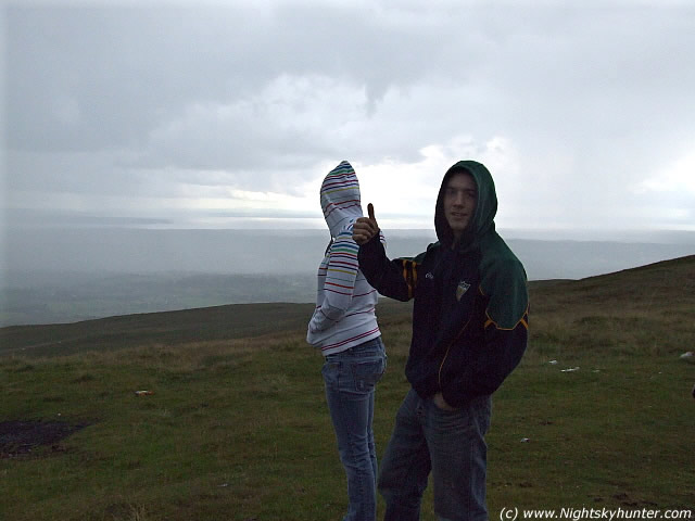 |
Conor and Christina survey the sky.
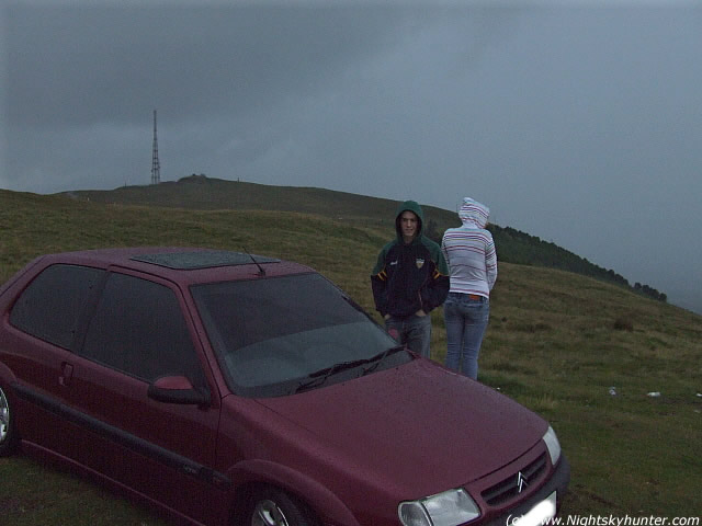 |
Conor, Christina, Car and rain. We went through hell to get to this position. The 'nail' on top of Slieve Gallion can be seen in the background. We where now over 500m above sea level.
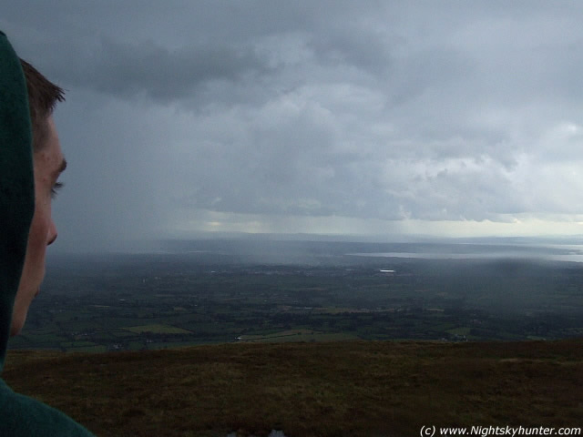 |
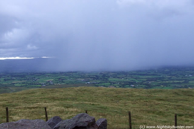
Conor observing rain curtains in the south.
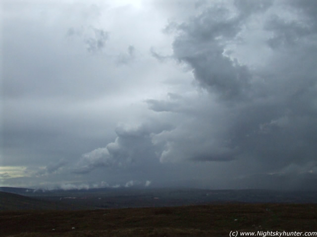 |
Decaying cumulus along the rear end of the thunderstorm.
 |
Another image.
When the conditions seemed a little safer Conor and I decided to run to the very top of the mountain which meant carrying gear, sprinting in rain and jumping over large puddles and marsh ground until we got to our destination. Loads of rain was still falling and overhead a dark grey Mammatus display was in progress with large high contrast pouches.
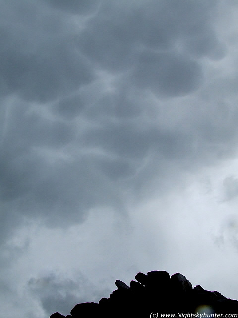 |
Mammatus display above the very top of the mountain. The rock pile below was the highest place in the area. Vertical image taken with fast shutter speed.
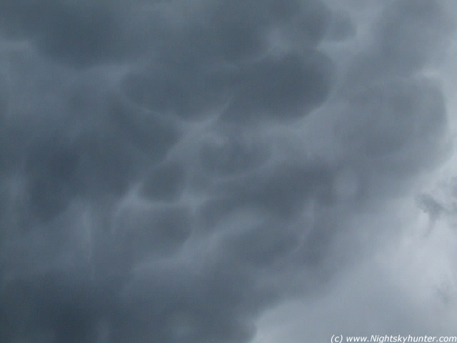 |
2nd shot of the Mammatus display. This time a horizontal image. Mamma are a sign of a decaying storm and indicate instability within the cloud.
The storm had now passed over us and was drifting north which gave us a good chance of imaging lightning activity from a side angle. Conor continued taking footage with the camcorder while I took hundreds of digital images. It was quite frightening as we where still in the danger zone. Lightning can strike up to 10 miles away from its parent storm and being on the top of a mountain was almost suicide!
 |
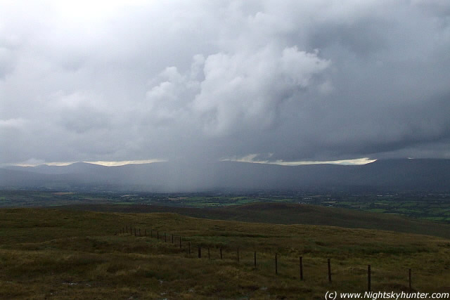
Hail curtains falling from the rear of the storm. This was heading north and away from us.
A very impressive rain and hail curtain was producing wonderful C-G's so it was only a matter of time before our dedication paid off. I changed my tactics and decided to use my camera's video footage which would dramatically increase my chances of success. It did!
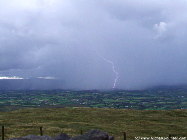 |
Still from video footage showing a beautiful C-G lightning strike which I caught.
 |
Three c-gs at the same time!. Another video grab.
Video footage taken by myself showing 4 C-G lightning strikes from the rear of the rain/hail curtain of the retreating storm. Watch out for the triple C-G's on the left and the large C-G at centre.
The show was over but what a day we had. We both obtained video footage of multiple lightning strikes, experienced loud thunder, and heavy hail. Yet another successful storm chase from N. Ireland! While driving down the mountain to lower ground it became apparent that the storm was much worse then we thought. The rain had unleashed loads of debris down hill leaving the narrow country roads covered with small rocks. One road was completely flooded until it looked like a small lake.
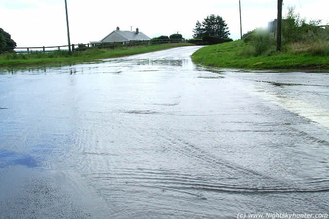 |
The road turned into a lake.
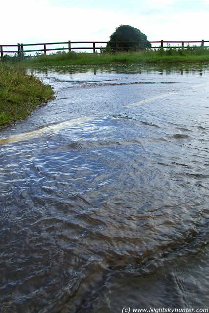 |
This was unbelievable!
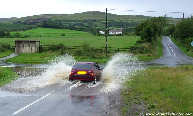 |
Conor ends the chase by driving through the flood.
The drive home was much more peaceful, the rain stopped and the Sun came out forming a colourful section of Rainbow in the east then we headed home. Conor, Christina and I had a wonderful experience and looked forward to more convective action in the days ahead...Martin McKenna
''Today was a success! I seen the start of the activity climbing upon us this evening so I called Martin and Christina and we headed off into the darkness. Within 10 miles we hit torrential rain, very strong wind (60mph) and hail to pea size. The rain got so bad we had to pull in, the car was getting battered by hail stones and it was amazing how loud it sounded. Then the lightning began, it was happening around every 5 - 10 sec's and cg's were hitting the fields around us. The storm was really intense and lasted for about 30 min's. When this passed we drove up to the mountain to to get a better view of the storm, the road was flooded and the stones and dirt on the road were awful. We reached the top and had the best view of lightning I have seen yet. All sorts of lightning was coming out of everywhere in this beast and the rain shafts were so intense. We also seen some lovely mama after the storm had moved on a great bit. I have 8 min's of video with lots and lightning and maybe not so good 'bad words''....Conor McDonald